Archivo:EspañaLoc.svg
From Wikimedia España
Jump to navigationJump to search
Size of this PNG preview of this SVG file: 800 × 457 pixels. Other resolutions: 320 × 183 pixels | 640 × 366 pixels | 1,024 × 585 pixels | 1,280 × 731 pixels | 3,300 × 1,885 pixels.
Original file (SVG file, nominally 3,300 × 1,885 pixels, file size: 1.9 MB)
Summary
| Description |
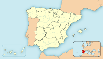
English: Location map of Spain
Equirectangular projection, N/S stretching 130 %. Geographic limits of the map:
Español: Mapa de localización de España
Proyección cilíndrica equidistante, N/S estirada 130 %. Límites geográficos del mapa:
|
|
| Date | ||
| Source | Own work | |
| Author | HansenBCN | |
| Other versions |
Derivative works of this file: |
|
| SVG development | This locator map was created with Inkscape.
|


Licensing
| I, the copyright holder of this work, release this work into the public domain. This applies worldwide. In some countries this may not be legally possible; if so: I grant anyone the right to use this work for any purpose, without any conditions, unless such conditions are required by law. |
File history
Click on a date/time to view the file as it appeared at that time.
| Date/Time | Thumbnail | Dimensions | User | Comment | |
|---|---|---|---|---|---|
| current | 14:22, 8 December 2010 | | 3,300 × 1,885 (1.9 MB) | Miguillen | quito bordes |
File usage
The following page uses this file: